Research
Inland hydrology validation of NASA’s Surface Water and Ocean Topography satellite
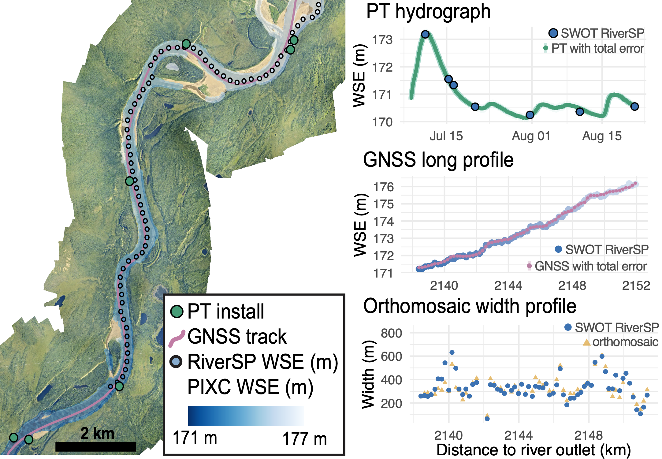
The recently launched Surface Water and Ocean Topography (SWOT) satellite enables global monitoring of water surface elevation (WSE), slope, and inundation extent, but in situ validation is essential to determine the accuracy and potential limitations of SWOT measurements before applications in hydrological sciences and water resource management. Working for three years as a Research Specialist under the NASA Hydrology Lead Dr. Tamlin Pavelsky at UNC Chapel Hill, I managed logistics for over nine months of field campaigns at five unique sites, collecting in situ data on water surface elevation, inundation extent, and discharge to validate SWOT. Collectively, my CalVal work demonstrates that SWOT is near meeting (width) or exceeding (WSE, slope) the accuracies necessary to characterize global spatiotemporal variations in water storage change and river discharge.
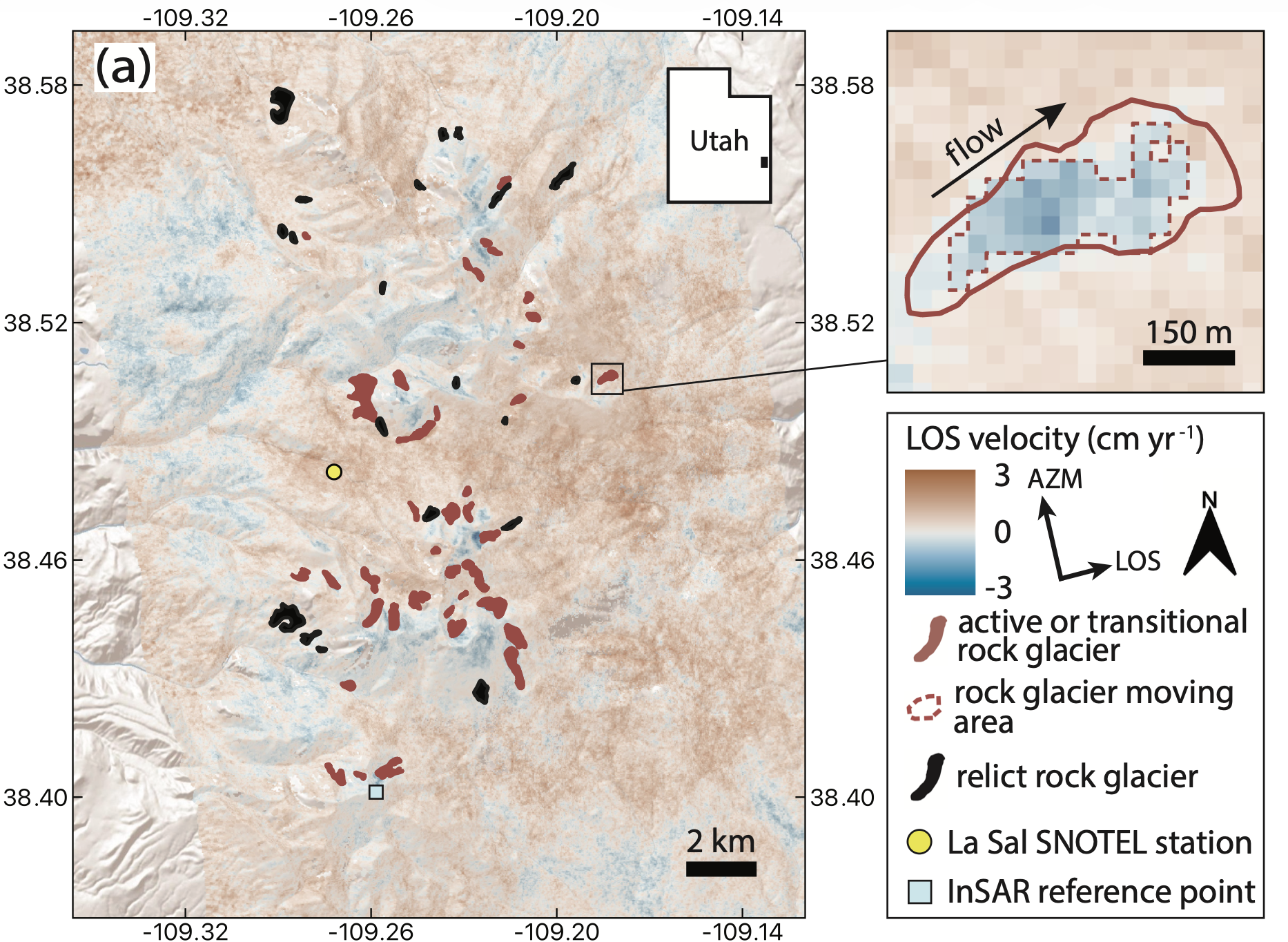
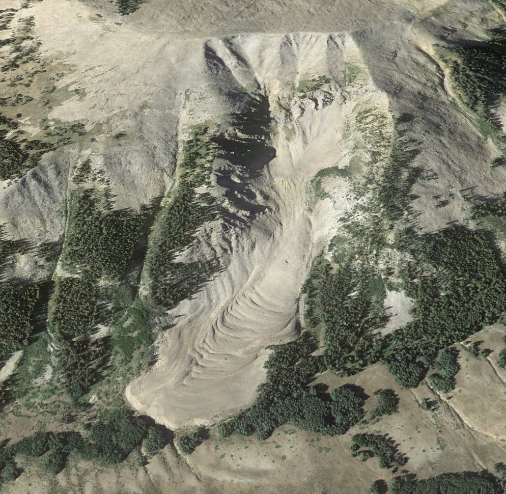
InSAR-based characterization of Utah rock glacier kinematics
Rock glaciers are common features in alpine environments that play an important role in hydrology and landscape evolution. For my senior thesis at Middlebury College, I used satellite-based radar interferometry, topographic data, and optical imagery to identify and characterize rock glacier motion in the La Sal Mountains, Utah, USA, from 2016–2024. This work was advised by geomorphologist Dr. Jeffery Munroe at Middlebury and radar specialist Dr. Alexander Handwerger at NASA’s Jet Propulsion Laboratory. Our resulting inventory includes 41 active and transitional rock glaciers and 20 relict features. Notably, these rock glaciers remain active or transitional despite being located above the 0 °C MAAT isotherm for the 1991–2020 climate normal, suggesting a resilience to rising air temperatures. Overall, our results provide insight into environmental controls on rock glacier kinematics and demonstrate an approach for developing inventories critical to improving estimates of alpine water storage.